Showing posts with label photomapping. Show all posts

Tuesday, December 24, 2013

Missed target, found hooliganism on drone mapping mission

A small unmanned aircraft system for mapping, developed for a National Science Foundation grant to improve STEM education.

In north Louisiana, there’s a fantastic little place known for Muscadine grapes, pecans, and on occasion, alligators.

Muscadines always get turned into jelly; an excellent topping for southern-style biscuits (my wife says she’s still working on mastering the family biscuit recipe, but she’s produced the finest biscuits I’ve ever had the pleasure of eating).

Pecans, a grocery bag of which could fetch a gold bar by northern exchange rates, are so plentiful that they must be given away. They’re so much a part of my wife’s heritage that we decided to get married beneath those pecan trees.

And when the water is high in the backyard bayou, a small alligator sometimes will make itself at home. If the alligator is lovingly cared for and becomes fat, a portion of that alligator eventually will make its way to our dinner table in the form of a delightful alligator sauce piquant (wife insists that it be cooked like shrimp, and not burnt to a crisp as it’s done here in the North).

So before we went down to visit my wife’s family farm for Thanksgiving, I decided to pack up one of the “drones” I’ve developed at the National Science Foundation grant where I work, to see if I couldn’t map out this interesting place.

Wednesday, October 3, 2012

Journalism Drone Development: aerial photo mosiacs, and what's the spatial resolution on this drone, anyway?


Above is an aerial mosaic -- a series of 11 photos taken from a small unmanned aerial vehicle (colloquially known as a drone) that have been stitched together in a mosaiking program.

That program, Microsoft Image Composite Editor, is normally used to stitch together a series of sweeping photos taken from the ground to make a single panoramic image. However, the algorithm used to find and match the edges of a series of sweeping photos of, say, the Grand Canyon, is the same algorithm needed to fit photos together to make a map or similar map-esque image from aerial photos.

So, what kind of drone journalism could you do with this kind of image? Aerial photographers have been able to capture a breathtaking, panoramic view of Moscow protests from drones. These drones offer a perspective that is especially helpful at documenting the scope or extent of protests, political rallies, construction projects, landmarks, geographic features, and natural and man-made disasters.

But what kind of data journalism can you do with these drones? That's to say, what kind of hard data can you obtain from these images to launch investigations? How about proving the existence of or extent of something, such as oil spills, wild fires, droughts, or lax construction codes following a disaster, with actual metrics?

Friday, July 27, 2012

Maker of the AR Drone invests in GIS. Is cheap, commerical drone mapping on the way?


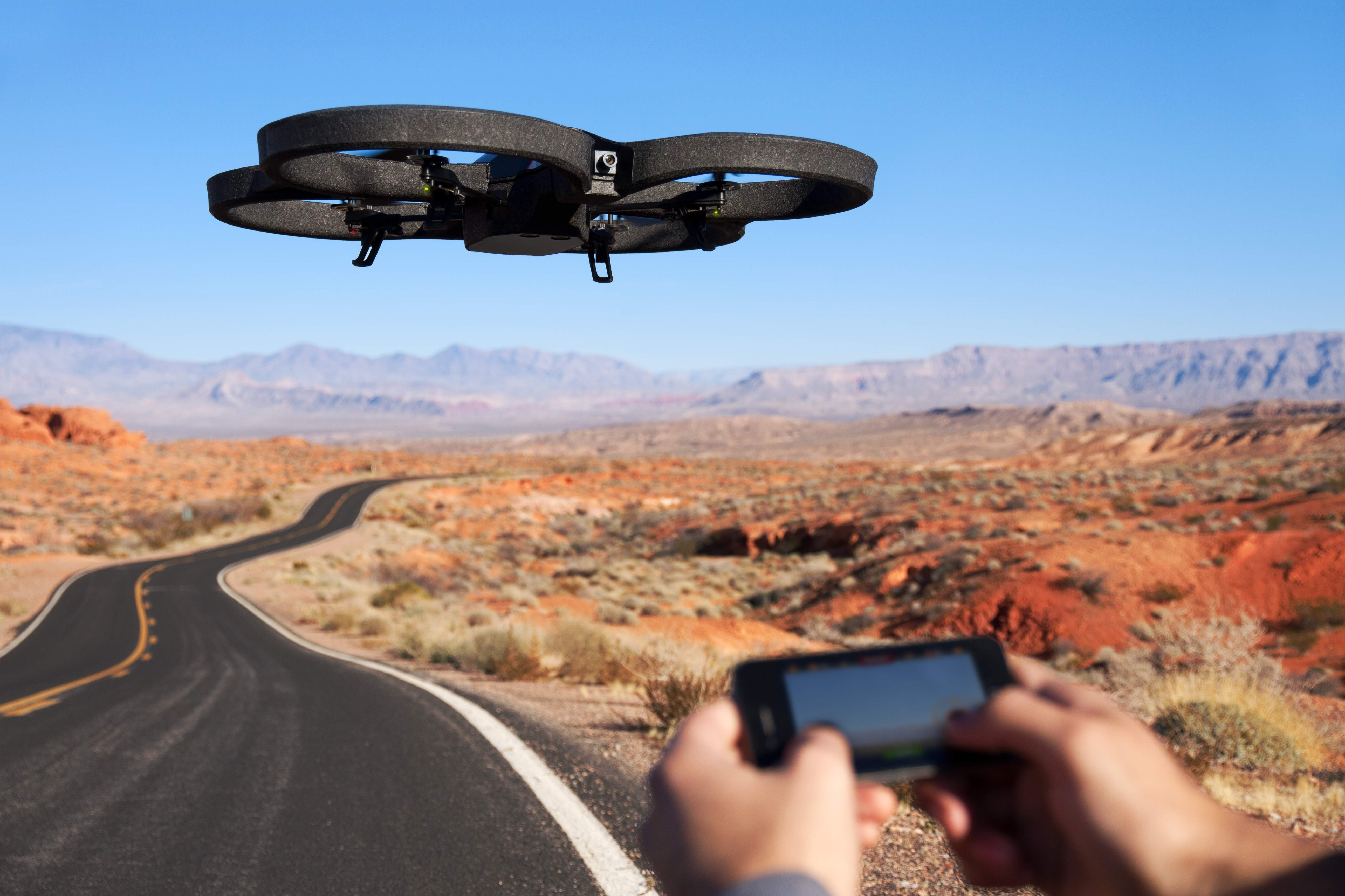
Many people's first introduction to commercial drones may have been the AR Drone by Parrot. Originally marketed as a futuristic RC toy you control via WiFi with an augmented reality iPhone AP, the AR Drone is a consumer-grade, $300 quadrotor with an HD Camera, the first of its kind that has been mass produced.

Parrot, the company that develops and manufactures the drone, have sold 300,000 ARs since 2010 (to put the number in perspective, the FAA estimates 1/10 that number of commercial drones will by flying in the national airspace alongside manned aircraft by 2020). It's also developed a user base that is constantly tweaking the drone and figuring out new uses.

Videographers have rigged the AR Drone with higher-end cameras and found ways to extend its range. Occupy activists have tried to hack them to broadcast live video of protests. They've also been tested as potential platforms to conduct drone journalism at The University of Nebraska's Drone Journalism Lab.

Yesterday, Pix4D, a company that specializes in making software that converts aerial shots from drones into 3D photomaps, announced that it would be receiving a $2.4 million investment from Parrot.

"With the fast technological advances in miniaturized autopilots and digital cameras, lightweight autonomous flying platforms are increasingly used to generate up-to-date and detailed environmental maps and geographical information data," Pix4D said in a press release. "Furthermore, recent changes to the regulatory framework for civilian drones will drive UAV adoption and help address the soaring demand for GIS data."

Christoph Strecha, CEO of Pix4D appeared in a recent video along with Jean-Christophe Zufferey, CEO of senseFly, who also received funding from Parrot. SenseFly produces the "Swinglet Cam," a micro drone system designed for photomapping missions.

In the video, Strecha said it would be "interesting" for his company to step into "To produce games, to produce augmented reality that can be done with quadrotors for the consumer market."

The investment from Parrot, who made quadrotors accessible to average consumer, begs the question as to whether the consumer electronics manufacturer will attempt to do with GIS photomapping what it did to commercial drones. Could a $300 drone mapping system be far off? Would journalists adopt such a device for their reporting? How about city planners, environmental researchers, and construction companies -- would they adopt it as well?

Pix4D hasn't responded yet to questions, but I will update if they do.

Joint video announcement by Pix4D and senseFly

A drone-generated photomap of Port Au Prince, Haiti, generated by Pix4D software.